The Smartest Route
Leire Calvillo y Ramón Cuesta
The Smartest Route
Leire Calvillo y Ramón Cuesta
Download PDF
12 pages
1,82 MB
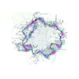
Plan of the Madrid periphery for the development of the free zone ring La Ruta Más Astuta (or The Smartest Route)
Introduction
The urban planning developments of the past 20 years have not been
completed and have set up the expansion of the city of Madrid in a
kind of apocalyptic landscape. A landscape shielded by
unconsummated financial interests and the obsolescence of a still
existing legal framework that soley supported the developers and
designers that planned it.
La Ruta Más Astuta [LRMA] is configured as a territory with the
legal regime of a free zone ring. It will have customs, borders,
tax benefits, new tax regulations and exceptions to the Organic
Law of Construction. The aim is promoting cultural and economic
development at the periphery of Madrid and transforming an
indeterminate, abstract, desert and uninhabited peripheral
territory, into a real, sheltered, playful and productive
landscape.
In addition, tourism in Spain, as an economic sector within the
service sector, accounts for 10% of GDP of the country’s economy
and therefore presents itself as a strong potential for growth and
development. Given such potential and the fact that Spain is one
of the main tourist destinations worldwide, LRMA aims to promote
the territory’s resources identified as obsolete and defend the
local identity establishing the necessary relationships between
this sector ( services) and the rest. In this way, it aims to
develop that economy linked to the local identity, generating a
coexistence of economies and resources.
This plan aims to set the legislative framework for the creation
and management of LRMA in Madrid, which is defined as a productive
and leisure ring for the city (…).
[Excerpt from the Plan of the Madrid periphery for the development
of the free zone ring La Ruta Más Astuta (or The Smartest Route)
(PdRMA)]
5 The project
1. Origin
The project is based on the identification of the two sides of the
peripheral post crisis landscapes in Madrid: on one hand,
abandonment; on the other hand, landscape potential; both
identified in the unfinished and paralyzed PAUs (urban development
projects) as a result of the economic crisis, but also identified
in other nearby peripheral sites (poles of attraction); that
create a ring around the capital.
2. Laws
The basis of the project is presented as a urban development plan
(PdRMA). It’s total area covers 4,000 ha along an annular route of
80 km with a varying width between 500 and 1000 m around Madrid.
It states a series of rules, strategies and modes of intervention
that can be summarized in 9 points and located on a legislative
map. Subsequently, a series of evolutionary hypotheses are
visualized and developed according to the PdRMA.
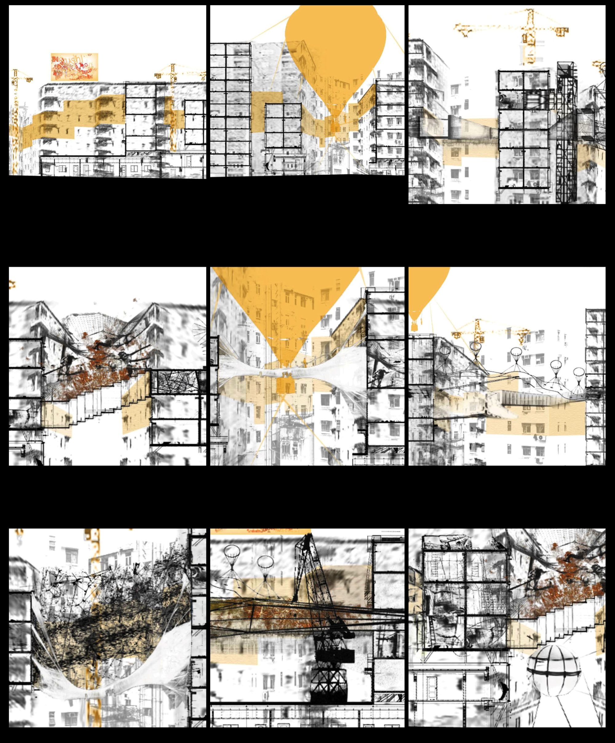
3. The Objects
In order to visualize the future hypothetical developments, a
series of physical structures are designed as part of a technical
catalogue.
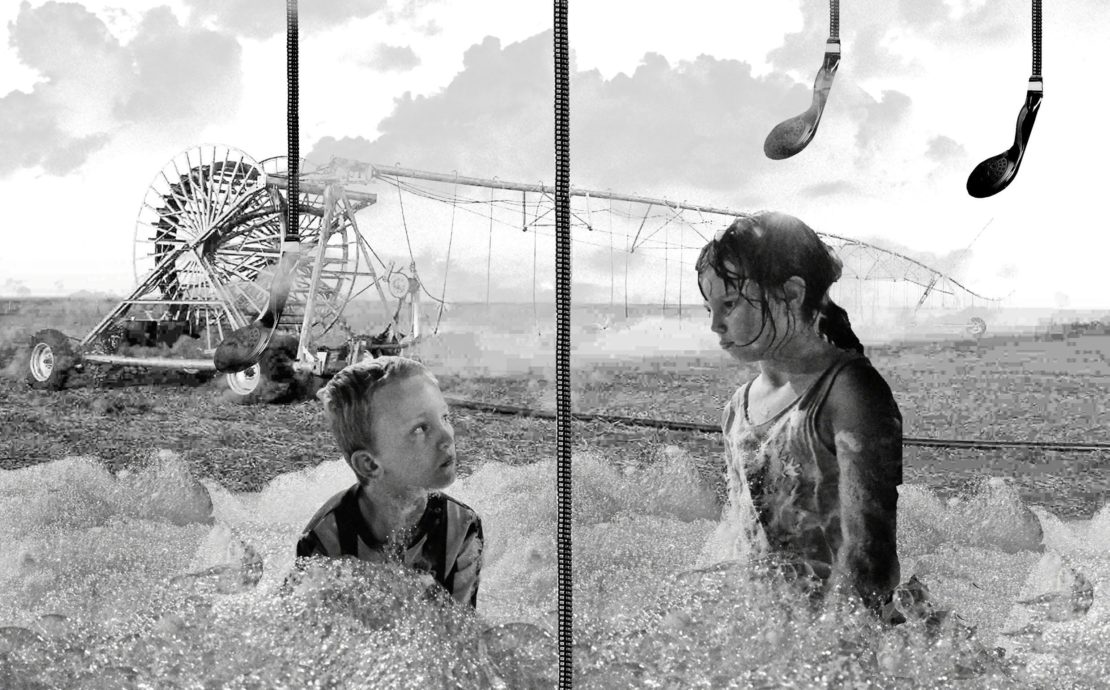
4. Hypothetical developments
Based on the previous points, two hypothetical future scenarios
are visualized: one in a 30-year time, and the other in a 60-year
time. In the first one, the basic infrastructure is settled
according to the PdRMA, and the historical uses of the land are
reimplemented. LRMA becomes an urban platform where recreational
and productive activities interact with each other.
In the second hypothesis, the Route explodes. Uses and activities
overlap with each other to achieve the maximum disorder within its
boundaries.
Communication: The Magazine
Credits
The Smartest Route.
Author:
Leire Calvillo and Ramón Cuesta
2016